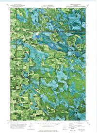
1973 Map of Erie NE
USGS Topo · Published 1976About this map
The Red Lake Indian Reservation dominates the southern landscape of this northern Minnesota survey, where the dense hydrology of the region meets a complex history of land demarcation. A prominent diagonal line marks the Old Indian Treaty Boundary, slicing through the terrain where Beltrami, Marshall, and Pennington counties converge. This orthophotomap, derived from 1969 aerial photography, reveals a mosaic of wetlands and forest patches characteristic of the area near the Carmel State Wildlife Management Area. Sparse human infrastructure is evident through scattered resource extraction sites like the Sandpit, connected by a grid of unimproved roads that trace the section lines across this remote wilderness during the early 1970s.
Find a feature on this map
7 named features on this map. Tap any name to fly to it.
Don’t see what you’re looking for? This feature index may not catch every label — zoom into the map to look around manually.
Map Details
Editions of this 1973 Erie NE Map
This is the sole edition of this map. No revisions or reprints were ever made.
Other maps of this area

1918 · Malcolm
USGS Topo · 1:62,500

1918 · Jelle
USGS Topo · 1:62,500

1919 · Liner
USGS Topo · 1:62,500

1954 · Roseau
USGS Topo · 1:250,000

1957 · Roseau
USGS Topo · 1:250,000

1958 · Roseau
USGS Topo · 1:250,000

1972 · Erie
USGS Topo · 1:24,000
1972 · Good Lake
USGS Topo · 1:24,000
1973 · Grygla
USGS Topo · 1:24,000
1973 · Grygla SW
USGS Topo · 1:24,000