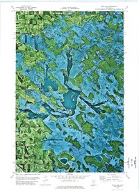
1972 Map of Good Lake
USGS Topo · Published 1976About this map
Rein and Hickory terrain define this 1970s orthophotomap landscape, where the shifting hydrology of Northern Minnesota is captured through high-altitude aerial photography. The sheet reveals a complex network of wetlands and wooded rises at the intersection of Pennington, Beltrami, and Clearwater counties. This specific survey is notable for showing the Red Lake Indian Reservation Boundary as it cuts across the saturated basin, providing a precise record of land division in a region defined by its water. A solitary Winter Trail meanders through the central marshes, likely serving as a seasonal lifeline for transport when the ground was frozen. Cultural markers are few but significant in this environment, including the Little Oak Cem and the eponymous Good Lake, which sits as a focal point among the numerous unnamed ponds and glacial depressions.
Find a feature on this map
8 named features on this map. Tap any name to fly to it.
Don’t see what you’re looking for? This feature index may not catch every label — zoom into the map to look around manually.
Map Details
Editions of this 1972 Good Lake Map
This is the sole edition of this map. No revisions or reprints were ever made.
Other maps of this area

1918 · Jelle
USGS Topo · 1:62,500

1919 · Churnes
USGS Topo · 1:62,500

1919 · Winsor
USGS Topo · 1:62,500

1954 · Bemidji
USGS Topo · 1:250,000

1954 · Roseau
USGS Topo · 1:250,000

1957 · Roseau
USGS Topo · 1:250,000

1957 · Bemidji
USGS Topo · 1:250,000

1958 · Bemidji
USGS Topo · 1:250,000

1958 · Roseau
USGS Topo · 1:250,000

1972 · Erie
USGS Topo · 1:24,000