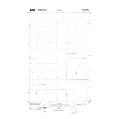
2013 Map of Carmel
USGS Topo · Published 2013About this map
The small settlement of Carmel sits at a crossroads in rural Beltrami County, defined by a rigid grid of local roads and the primary artery of MN-89. This landscape is primarily characterized by its low-lying, poorly drained terrain, with numerous small, unnamed wetland pockets scattered across the survey. The development pattern follows the sectional lines typical of Northern Minnesota's agricultural and timber lands, with local routes like Gunpowder Rd NW and Englund Rd NW providing access to isolated farmsteads and rural residences.
Find a feature on this map
12 named features on this map. Tap any name to fly to it.
Don’t see what you’re looking for? This feature index may not catch every label — zoom into the map to look around manually.
Map Details
Editions of this 2013 Carmel Map
This is the sole edition of this map. No revisions or reprints were ever made.
Other maps of this area

1918 · Malcolm
USGS Topo · 1:62,500

1918 · Jelle
USGS Topo · 1:62,500

1919 · Liner
USGS Topo · 1:62,500

1954 · Roseau
USGS Topo · 1:250,000

1957 · Roseau
USGS Topo · 1:250,000

1958 · Roseau
USGS Topo · 1:250,000

1973 · Gates Corner
USGS Topo · 1:24,000
1973 · Grygla
USGS Topo · 1:24,000
1973 · Erie NE
USGS Topo · 1:24,000

1973 · Jelle NE
USGS Topo · 1:24,000