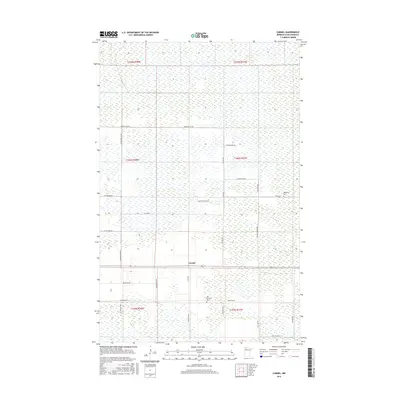
2016 Map of Carmel
USGS Topo · Published 2016About this map
The small settlement of Carmel anchors this northern Minnesota landscape, characterized by a grid-like network of rural roads and expansive wetlands. Located in Beltrami County, the area is defined by its agricultural and forest management history, evidenced by the rectilinear property lines of the Public Land Survey System. Local heritage is preserved at sites like Sundberg Cem and Our Saviours Cem, which serve as quiet landmarks for genealogists and local historians. The transport network consists primarily of gravel and paved roads named for local families and natural features, including Gunpowder Rd Nw, Hamre Rd Nw, and Grandy Corner Rd. This survey documents a quiet rural community where the landscape is structured by township and range boundaries such as t156n r37w.
Find a feature on this map
31 named features on this map. Tap any name to fly to it.
Don’t see what you’re looking for? This feature index may not catch every label — zoom into the map to look around manually.
Map Details
Editions of this 2016 Carmel Map
This is the sole edition of this map. No revisions or reprints were ever made.
Other maps of this area

1918 · Malcolm
USGS Topo · 1:62,500

1918 · Jelle
USGS Topo · 1:62,500

1919 · Liner
USGS Topo · 1:62,500

1954 · Roseau
USGS Topo · 1:250,000

1957 · Roseau
USGS Topo · 1:250,000

1958 · Roseau
USGS Topo · 1:250,000

1973 · Gates Corner
USGS Topo · 1:24,000
1973 · Grygla
USGS Topo · 1:24,000
1973 · Erie NE
USGS Topo · 1:24,000

1973 · Jelle NE
USGS Topo · 1:24,000