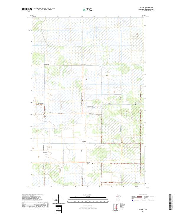
2022 Map of Carmel
USGS Topo · Published 2022About this map
The tiny settlement of Carmel anchors this northern Minnesota landscape, situated within a vast network of wetlands and conservation lands in Beltrami County. Modern-era navigation in this area is defined by a grid of rural roads and long-distance recreational paths, most notably the Consolidated Conservation Trails Trl and the Fourtown-Grygla Trail System Trl which weave through the townships. The map reflects a landscape where the human footprint is light, primarily consisting of scattered rural residences and family-named roads like Englund Rd NW and Stanton Rd NW.
Find a feature on this map
31 named features on this map. Tap any name to fly to it.
Don’t see what you’re looking for? This feature index may not catch every label — zoom into the map to look around manually.
Map Details
Editions of this 2022 Carmel Map
This is the sole edition of this map. No revisions or reprints were ever made.
Other maps of this area

1918 · Malcolm
USGS Topo · 1:62,500

1918 · Jelle
USGS Topo · 1:62,500

1919 · Liner
USGS Topo · 1:62,500

1954 · Roseau
USGS Topo · 1:250,000

1957 · Roseau
USGS Topo · 1:250,000

1958 · Roseau
USGS Topo · 1:250,000

1973 · Gates Corner
USGS Topo · 1:24,000
1973 · Grygla
USGS Topo · 1:24,000
1973 · Erie NE
USGS Topo · 1:24,000

1973 · Jelle NE
USGS Topo · 1:24,000