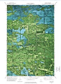
1973 Map of Carmel
USGS Topo · Published 1976About this map
Beltrami Island State Forest dominates the northern landscape of this orthophotomap, revealing the dense woodland and wetlands of northern Beltrami County. This 1973 survey provides an overhead photographic view of the rural settlement patterns at Carmel, where the land transitions from forest to a structured grid of agricultural fields. The intersection of these environments is marked by early community landmarks such as Our Saviours Ch and the Sundberg Cem in Spruce Grove. The map details the township boundaries of Benville, Lee, and Hamre, offering researchers a clear look at the drainage patterns and small-scale land use, including a local Gravel Pit. This hybrid map style, combining aerial photography with topographic data, allows for a precise study of the vegetation and road networks during the mid-1970s.
Find a feature on this map
9 named features on this map. Tap any name to fly to it.
Don’t see what you’re looking for? This feature index may not catch every label — zoom into the map to look around manually.
Map Details
Editions of this 1973 Carmel Map
This is the sole edition of this map. No revisions or reprints were ever made.
Other maps of this area

1918 · Malcolm
USGS Topo · 1:62,500

1918 · Jelle
USGS Topo · 1:62,500

1919 · Liner
USGS Topo · 1:62,500

1954 · Roseau
USGS Topo · 1:250,000

1957 · Roseau
USGS Topo · 1:250,000

1958 · Roseau
USGS Topo · 1:250,000

1973 · Gates Corner
USGS Topo · 1:24,000
1973 · Grygla
USGS Topo · 1:24,000
1973 · Erie NE
USGS Topo · 1:24,000

1973 · Jelle NE
USGS Topo · 1:24,000