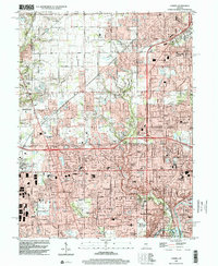
2022 Map of Carmel
USGS Topo · Published 2022About this map
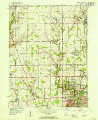
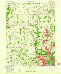
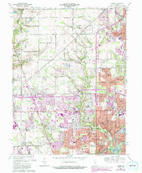
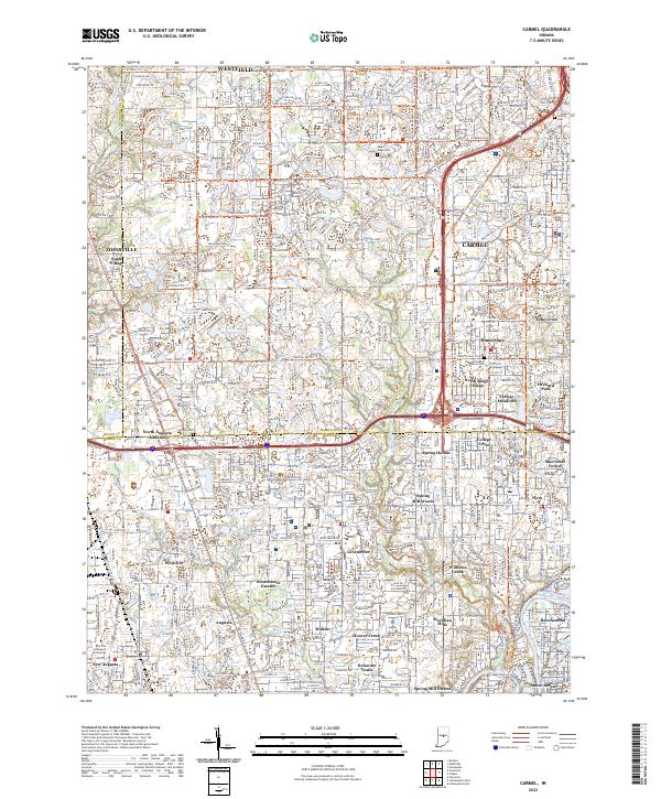
Carmel and Westfield anchor this contemporary look at the suburban expansion north of Indianapolis, where the transition from rural agricultural roots to dense residential development is nearly complete. The landscape is heavily defined by named subdivisions such as Echo Crest, Home Place, and College Meadows, alongside established neighborhoods like Williams Creek and Meridian Hills. A historical layer remains visible through the Monon Rail Trl, which follows the path of the old Monon Railroad through the heart of the city, and several significant burial grounds including Carmel Cem and Poplar Ridge Cem. In the southern portion of the map, the White River and Crooked Cr wind through the terrain near Ravenswood and Shore Acres, while the industrial and educational presence is marked by the Lincoln College of Technology near New Augusta.
Find a feature on this map
83 named features on this map. Tap any name to fly to it.
Don’t see what you’re looking for? This feature index may not catch every label — zoom into the map to look around manually.
Map Details
Editions of this 2022 Carmel Map
This is the sole edition of this map. No revisions or reprints were ever made.
Historical Maps of Holida Through Time
5 maps found