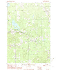
1982 Map of Carmel
USGS Topo · Published 1983About this map
Souadabscook Stream and the Maine Central railroad corridor define the central valley of this Penobscot County landscape, serving as a primary transit artery between the settlements of Etna and Carmel. The map reveals a community structured around small crossroads and family landmarks, with several established burial grounds such as Coboro Cem and Highland Cem providing important data points for genealogical research. To the west, the expansive Etna Bog and Pleasant Lake dominate the terrain, illustrating the significant wetland systems that have historically shaped local land use and development. Educational and social centers are clearly marked, including the Caravel Jr High Sch and the Bible Conference grounds near the town center. Smaller, specialized features like the Ring Hill Airport and various Sand & Gravel pits speak to the local industry and utility of the era.
Find a feature on this map
37 named features on this map. Tap any name to fly to it.
Don’t see what you’re looking for? This feature index may not catch every label — zoom into the map to look around manually.
Map Details
Editions of this 1982 Carmel Map
2 editions found
Other maps of this area

1900 · Bucksport
USGS Topo · 1:62,500

1902 · Bucksport
USGS Topo · 1:62,500

1902 · Bangor
USGS Topo · 1:62,500

1931 · Stetson
USGS Topo · 1:48,000

1932 · Brooks
USGS Topo · 1:62,500

1935 · Stetson
USGS Topo · 1:62,500

1942 · Bangor
USGS Topo · 1:62,500

1942 · Bucksport
USGS Topo · 1:62,500

1946 · Bangor
USGS Topo · 1:62,500

1948 · Bangor
USGS Topo · 1:250,000