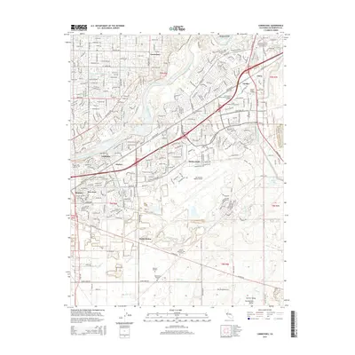
2015 Map of Carmichael
USGS Topo · Published 2015About this map
The American River corridor serves as the central anchor for this 2015 study of eastern Sacramento County, where the transition from established suburban communities like Carmichael to the industrial and aeronautical infrastructure of Mather Field is clearly defined. The landscape is marked by the expansive footprint of the Sacramento Mather Airport and the surrounding aviation facilities, highlighting the region's enduring military and commercial flight legacy. South of the river, the map detail captures the residential growth of Rosemont and La Riviera, while the southern reaches reveal a more open landscape punctuated by several significant burial grounds, including the Bellevue Cemetery and Camellia Memorial Lawn Cemetery. Water drainage patterns are intricately mapped through seasonal systems like Morrison Cr and Elder Cr, which navigate the terrain alongside historic transit routes and the Southern Pacific railroad line through Walsh Station.
Find a feature on this map
42 named features on this map. Tap any name to fly to it.
Don’t see what you’re looking for? This feature index may not catch every label — zoom into the map to look around manually.
Map Details
Editions of this 2015 Carmichael Map
This is the sole edition of this map. No revisions or reprints were ever made.
Other maps of this area

1891 · Sacramento
USGS Topo · 1:125,000

1892 · Sacramento
USGS Topo · 1:125,000

1893 · Sacramento
USGS Topo · 1:125,000

1894 · Lodi
USGS Topo · 1:125,000

1902 · Fairoaks
USGS Topo · 1:62,500

1908 · Buffalo Creek
USGS Topo · 1:31,680

1909 · Elk Grove
USGS Topo · 1:31,680

1909 · Cosumnes
USGS Topo · 1:31,680

1909 · Florin
USGS Topo · 1:31,680

1911 · Brighton
USGS Topo · 1:31,680