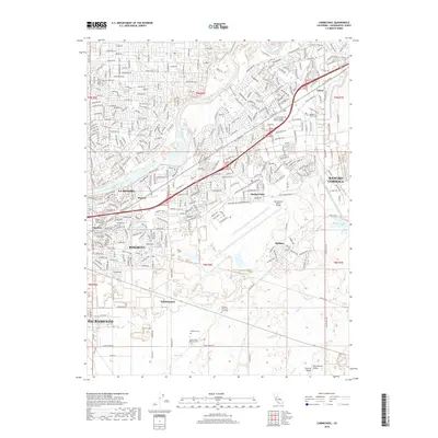
2018 Map of Carmichael
USGS Topo · Published 2018About this map
The American River winds through the northern portion of this map, dividing the established residential areas of Carmichael from the industrial and aviation hubs of Rancho Cordova. This landscape is defined by the significant footprint of Mather Field, anchored by the Sacramento Mather Airport, and the agricultural legacy visible at Walsh Station. The southern reaches transition into more open terrain, where the Folsom South Canal and several creeks, including Morrison Cr and Elder Cr, drain toward the valley floor.
Find a feature on this map
158 named features on this map. Tap any name to fly to it.
Don’t see what you’re looking for? This feature index may not catch every label — zoom into the map to look around manually.
Map Details
Editions of this 2018 Carmichael Map
This is the sole edition of this map. No revisions or reprints were ever made.
Other maps of this area

1891 · Sacramento
USGS Topo · 1:125,000

1892 · Sacramento
USGS Topo · 1:125,000

1893 · Sacramento
USGS Topo · 1:125,000

1894 · Lodi
USGS Topo · 1:125,000

1902 · Fairoaks
USGS Topo · 1:62,500

1908 · Buffalo Creek
USGS Topo · 1:31,680

1909 · Elk Grove
USGS Topo · 1:31,680

1909 · Cosumnes
USGS Topo · 1:31,680

1909 · Florin
USGS Topo · 1:31,680

1911 · Brighton
USGS Topo · 1:31,680