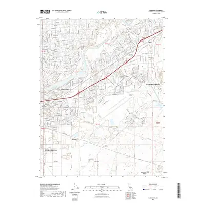
2022 Map of Carmichael
USGS Topo · Published 2022About this map
The American River corridor serves as the primary geographical anchor for this part of the Sacramento Valley, where dense suburban expansion meets the legacy of early transportation routes. Inland from the river, the landscape is defined by the historic operations of Mather Field and the Sacramento Mather Airport, reflecting the area's mid-century aviation and military importance. Residential growth centers on established communities like Rosemont and Rancho Cordova, while older nodes such as Mayhew, Manlove, and Walsh Station point to the corridor's long history as a transit artery between the capital and the Sierra foothills.
Find a feature on this map
36 named features on this map. Tap any name to fly to it.
Don’t see what you’re looking for? This feature index may not catch every label — zoom into the map to look around manually.
Map Details
Editions of this 2022 Carmichael Map
This is the sole edition of this map. No revisions or reprints were ever made.
Other maps of this area

1891 · Sacramento
USGS Topo · 1:125,000

1892 · Sacramento
USGS Topo · 1:125,000

1893 · Sacramento
USGS Topo · 1:125,000

1894 · Lodi
USGS Topo · 1:125,000

1902 · Fairoaks
USGS Topo · 1:62,500

1908 · Buffalo Creek
USGS Topo · 1:31,680

1909 · Elk Grove
USGS Topo · 1:31,680

1909 · Cosumnes
USGS Topo · 1:31,680

1909 · Florin
USGS Topo · 1:31,680

1911 · Brighton
USGS Topo · 1:31,680