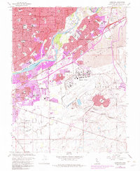
2023 Map of Carmichael
USGS Topo · Published 2023About this map
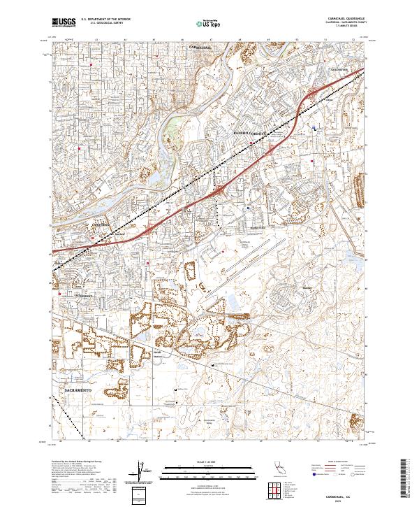
The Lower American Wild and Scenic River and the American River corridor define the landscape of eastern Sacramento County, separating the suburban developments of Carmichael from the industrial and aviation hubs of Rancho Cordova. This contemporary survey shows a high-density urban-suburban interface characterized by significant infrastructure, including the Sacramento Mather Airport and the engineered path of the Folsom South Canal. South of the residential corridors, the landscape opens into the Sacramento Valley, where large open-space tracts are punctuated by local drainage systems like Morrison Creek and Elder Creek. For researchers, the map provides precise locations for several commemorative sites such as Camellia Memorial Lawn Cem and Quiet Haven Memorial Park, alongside the transitioning land use around Mather and the namesake Mather Lake.
Find a feature on this map
45 named features on this map. Tap any name to fly to it.
Don’t see what you’re looking for? This feature index may not catch every label — zoom into the map to look around manually.
Map Details
Editions of this 2023 Carmichael Map
This is the sole edition of this map. No revisions or reprints were ever made.
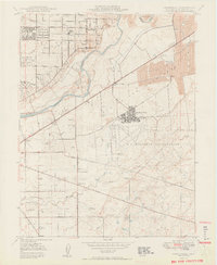
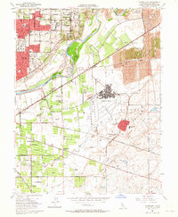
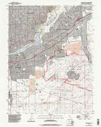
Historical Maps of Soudan Through Time
5 maps found