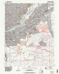
1992 Map of Carmichael
USGS Topo · Published 1997About this map
Mather Air Force Base dominates the southeastern quadrant of this study, reflecting the military and aviation footprint of the Sacramento area in the early 1990s. The site includes Sacramento Mather Airport and substantial infrastructure surrounding it, bounded by Kiefer Boulevard and Placerville Road. To the north, the American River carves a winding path through the American River Parkway, separating the suburban developments of Carmichael from Rancho Cordova. This landscape preserves several distinct burial grounds for genealogical research, including the Mathew Kilgore Cemetery and Arlington Memorial Cemetery. The transition from suburban residential grids north of Folsom Boulevard to the industrial and extraction zones near Morrison Creek, marked by several Gravel Pits, illustrates the region's mid-century expansion and ongoing resource management.
Find a feature on this map
36 named features on this map. Tap any name to fly to it.
Don’t see what you’re looking for? This feature index may not catch every label — zoom into the map to look around manually.
Map Details
Editions of this 1992 Carmichael Map
This is the sole edition of this map. No revisions or reprints were ever made.
Other maps of this area

1891 · Sacramento
USGS Topo · 1:125,000

1892 · Sacramento
USGS Topo · 1:125,000

1893 · Sacramento
USGS Topo · 1:125,000

1894 · Lodi
USGS Topo · 1:125,000

1902 · Fairoaks
USGS Topo · 1:62,500

1908 · Buffalo Creek
USGS Topo · 1:31,680

1909 · Elk Grove
USGS Topo · 1:31,680

1909 · Cosumnes
USGS Topo · 1:31,680

1909 · Florin
USGS Topo · 1:31,680

1911 · Brighton
USGS Topo · 1:31,680