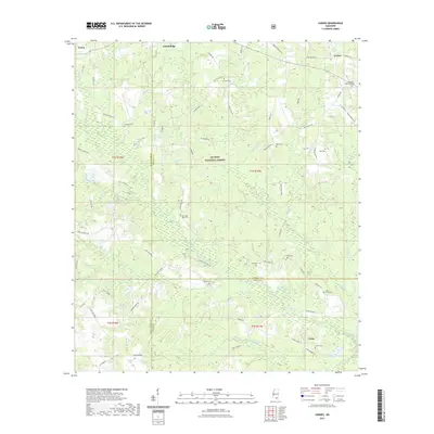
2021 Map of Carnes
USGS Topo · Published 2021About this map
De Soto National Forest covers much of this landscape, where the borders of Forrest, Stone, and Pearl River counties converge. The terrain is defined by a dense network of drainages, including Red Creek, Hickory Cr, and Double Br, which cut through the timbered lowlands. Small settlements such as Carnes, Texas, and Pistol Ridge are connected by a web of local routes like Hickory Grove Rd and Frog Bottom Rd. For genealogists, the map is remarkably detailed, documenting numerous family-named burial sites including the J E Bounds Memorial Cem, Landrum Cem, and the Lott/ Smith Cem. This density of small family cemeteries alongside features like Old Sand Hill Cem suggests a long-standing pattern of rural homesteading and localized community centers within the forest's bounds.
Find a feature on this map
80 named features on this map. Tap any name to fly to it.
Don’t see what you’re looking for? This feature index may not catch every label — zoom into the map to look around manually.
Map Details
Editions of this 2021 Carnes Map
This is the sole edition of this map. No revisions or reprints were ever made.
Other maps of this area

1947 · Wiggins
USGS Topo · 1:62,500

1947 · New Augusta
USGS Topo · 1:62,500

1949 · Wiggins
USGS Topo · 1:62,500

1949 · New Augusta
USGS Topo · 1:62,500

1953 · Hattiesburg
USGS Topo · 1:250,000

1953 · Mobile
USGS Topo · 1:250,000

1957 · Mobile
USGS Topo · 1:250,000

1958 · Hattiesburg
USGS Topo · 1:250,000

1958 · Carnes
USGS Topo · 1:62,500

1960 · Mobile
USGS Topo · 1:250,000