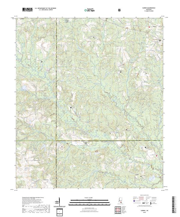
2024 Map of Carnes
USGS Topo · Published 2024About this map
De Soto National Forest dominates much of this landscape, where the borders of Forrest, Stone, and Pearl River counties meet. The settlement of Carnes serves as a primary hub in the northeast, while smaller communities like Young, Texas, and Pistol Ridge are dispersed among a complex network of waterways. The terrain is defined by the winding course of Red Creek and its numerous tributaries, including Hickory Creek and White Oak Branch. For those researching local lineages, the map is remarkably dense with family-named burial sites, including Landrum Cem, Fairley Cem, and Lott Smith Cem. This high concentration of family cemeteries, such as the J E Bounds Memorial Cem, indicates a deep-rooted history of rural family landholdings and small-scale settlements across the South Mississippi piney woods.
Find a feature on this map
76 named features on this map. Tap any name to fly to it.
Don’t see what you’re looking for? This feature index may not catch every label — zoom into the map to look around manually.
Map Details
Editions of this 2024 Carnes Map
This is the sole edition of this map. No revisions or reprints were ever made.
Other maps of this area

1947 · Wiggins
USGS Topo · 1:62,500

1947 · New Augusta
USGS Topo · 1:62,500

1949 · Wiggins
USGS Topo · 1:62,500

1949 · New Augusta
USGS Topo · 1:62,500

1953 · Hattiesburg
USGS Topo · 1:250,000

1953 · Mobile
USGS Topo · 1:250,000

1957 · Mobile
USGS Topo · 1:250,000

1958 · Hattiesburg
USGS Topo · 1:250,000

1958 · Carnes
USGS Topo · 1:62,500

1960 · Mobile
USGS Topo · 1:250,000