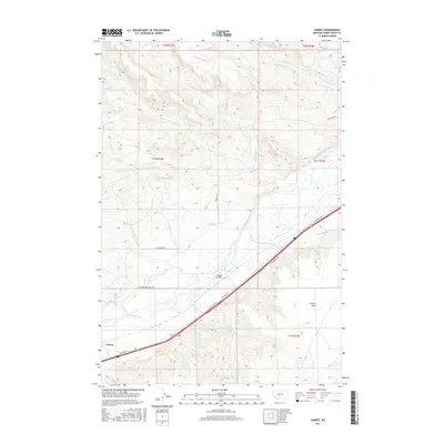
2017 Map of Carney
USGS Topo · Published 2017About this map
The Yellowstone River serves as the central artery of this landscape, carving through the terrain alongside significant irrigation works like the Post-Kellogg Ditch and Bellevue Ditch. The settlement of Carney sits in the southwestern corner, anchored by the modern Frontage Rd and historic routes such as the N Yellowstone Trail Rd. This transportation corridor reflects the long-standing importance of the river valley for movement across the region.
Find a feature on this map
28 named features on this map. Tap any name to fly to it.
Don’t see what you’re looking for? This feature index may not catch every label — zoom into the map to look around manually.
Map Details
Editions of this 2017 Carney Map
This is the sole edition of this map. No revisions or reprints were ever made.
Other maps of this area

1891 · Livingston
USGS Topo · 1:250,000

1891 · Big Timber
USGS Topo · 1:125,000

1893 · Livingston
USGS Topo · 1:250,000

1893 · Big Timber
USGS Topo · 1:125,000

1947 · Bozeman
USGS Topo · 1:250,000

1948 · Bozeman
USGS Topo · 1:250,000
1951 · Grosfield Ranch
USGS Topo · 1:24,000
1951 · Raspberry Butte
USGS Topo · 1:24,000

1951 · Kelly Hills
USGS Topo · 1:24,000

1951 · Springdale
USGS Topo · 1:24,000