
1950 Map of Carns
USGS Topo · Published 1950About this map
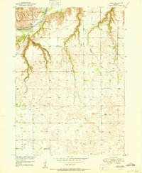
The Niobrara River carves through the northwestern corner of this territory, marking the border between Keya Paha and Rock counties. This 1950 survey, conducted as part of the Department of the Interior’s Missouri River Basin development program, captures a rural landscape defined by wide creek drainages and a sparse network of country schools. The small settlement of Carns sits near the river, while the surrounding tablelands are dotted with several local education centers including Rock Creek Sch, Dugger Sch, and Turkey Foot Sch. Numerous watercourses such as Willow Creek and Sand Creek cut through the sandy terrain, reflecting the drainage patterns that shaped ranching and farming in these northern Nebraska townships. Genealogists may find particular value in the location of Willowdale Cem and the Willowdale Sch nearby, providing a look at this community before later 20th-century consolidation.
Find a feature on this map
20 named features on this map. Tap any name to fly to it.
Don’t see what you’re looking for? This feature index may not catch every label — zoom into the map to look around manually.
Map Details
Editions of this 1950 Carns Map
2 editions found
Other maps of this area

1949 · Jamison SW
USGS Topo · 1:24,000

1949 · Riverview
USGS Topo · 1:24,000

1949 · Carns
USGS Topo · 1:24,000

1950 · Riverview
USGS Topo · 1:24,000

1950 · Mariaville
USGS Topo · 1:24,000

1951 · Jamison SW
USGS Topo · 1:24,000

1954 · Newport NE
USGS Topo · 1:24,000

1954 · Bassett
USGS Topo · 1:24,000

1954 · Newport
USGS Topo · 1:24,000

1954 · Newport SW
USGS Topo · 1:24,000