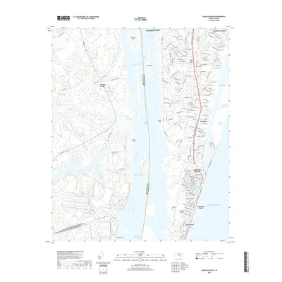
2019 Map of Carolina Beach
USGS Topo · Published 2019About this map
Pleasure Island stands as a central landform in this coastal survey, defined by its position between the Cape Fear River and the Atlantic Ocean. The landscape is bisected by Snows Cut, which connects the river to the Intracoastal Waterway. On the island's ocean-facing side, the residential grids of Carolina Beach, Wilmington Beach, and Kure Beach show the dense development of this resort region, centered around landmarks like Carolina Lake.
Find a feature on this map
178 named features on this map. Tap any name to fly to it.
Don’t see what you’re looking for? This feature index may not catch every label — zoom into the map to look around manually.
Map Details
Editions of this 2019 Carolina Beach Map
This is the sole edition of this map. No revisions or reprints were ever made.
Other maps of this area

1942 · Wilmington
USGS Topo · 1:62,500

1943 · Funston
USGS Topo · 1:24,000

1943 · Winnabow
USGS Topo · 1:24,000

1944 · Winnabow
USGS Topo · 1:31,680

1946 · Southport
USGS Topo · 1:24,000

1946 · Snow Marsh
USGS Topo · 1:24,000

1948 · Wilmington
USGS Topo · 1:62,500

1949 · Georgetown
USGS Topo · 1:250,000

1950 · Winnabow
USGS Topo · 1:25,000

1953 · Florence
USGS Topo · 1:250,000