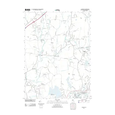
2012 Map of Carolina
USGS Topo · Published 2012About this map
The Pawcatuck River and its numerous tributaries, including Meadow Brook and Beaver River, carve through this southern Rhode Island landscape. The mapping reflects a region deeply connected to its indigenous history, clearly marking the Royal Indian Burial Ground and the Charlestown Indian Burying Ground, alongside more modern scientific landmarks like the Frosty Drew Observatory. This era shows the continued industrial presence of the Shannock Mill Complex near Horseshoe Falls, where the river powered the local economy.
Find a feature on this map
179 named features on this map. Tap any name to fly to it.
Don’t see what you’re looking for? This feature index may not catch every label — zoom into the map to look around manually.
Map Details
Editions of this 2012 Carolina Map
This is the sole edition of this map. No revisions or reprints were ever made.
Other maps of this area

1889 · Stonington
USGS Topo · 1:62,500

1889 · Charlestown
USGS Topo · 1:62,500

1889 · Moosup
USGS Topo · 1:62,500

1890 · Kent
USGS Topo · 1:62,500

1893 · Moosup
USGS Topo · 1:62,500

1893 · Stonington
USGS Topo · 1:62,500

1894 · Kent
USGS Topo · 1:62,500

1919 · Charlestown
USGS Topo · 1:62,500

1920 · Moosup
USGS Topo · 1:62,500

1921 · Charlestown
USGS Topo · 1:62,500