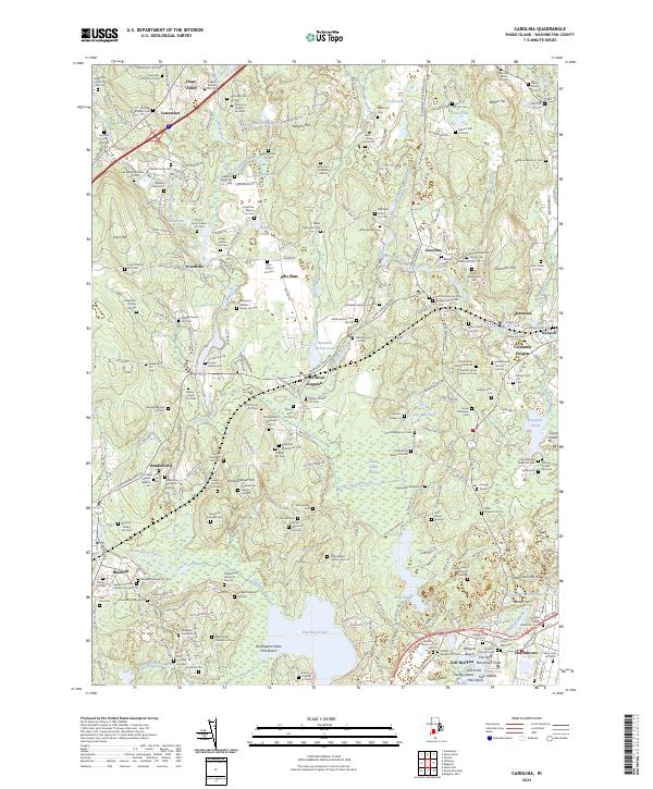
2024 Map of Carolina
USGS Topo · Published 2024About this map
The Wood River and Pawcatuck River systems dominate this landscape, defining the historical boundaries and industrial settlement patterns of Washington County. Industrial hamlets like Carolina and Shannock are situated along these waterways, with the Amtrak corridor passing through Wood River Junction and Kenyon. The area is notably dense with family burial grounds, including the Richmond Historical Cem 92 and the David Larkin Lot Cem, which provide a genealogical record of the region's early farming families. To the south, the terrain transitions into the coastal wetlands of the Ninigret National Wildlife Refuge and the sandy reaches of Burlingame State Park Beach. Large water bodies like Watchaug Pond and Deep Pond punctuate the southern half of the map, while inland heights such as Shannock Hill and Shumunkanuc Hill rise above the river valleys.
Find a feature on this map
156 named features on this map. Tap any name to fly to it.
Don’t see what you’re looking for? This feature index may not catch every label — zoom into the map to look around manually.
Map Details
Editions of this 2024 Carolina Map
This is the sole edition of this map. No revisions or reprints were ever made.
Other maps of this area

1889 · Stonington
USGS Topo · 1:62,500

1889 · Charlestown
USGS Topo · 1:62,500

1889 · Moosup
USGS Topo · 1:62,500

1890 · Kent
USGS Topo · 1:62,500

1893 · Moosup
USGS Topo · 1:62,500

1893 · Stonington
USGS Topo · 1:62,500

1894 · Kent
USGS Topo · 1:62,500

1919 · Charlestown
USGS Topo · 1:62,500

1920 · Moosup
USGS Topo · 1:62,500

1921 · Charlestown
USGS Topo · 1:62,500