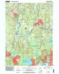
2001 Map of Carolina
USGS Topo · Published 2003About this map
The Pawcatuck River and its tributaries define this landscape at the turn of the 21st century, where industrial hamlets like Carolina and Shannock sit amidst an expansive network of protected lands. The map details a unique intersection of history and geography in southern Rhode Island, particularly within the Narragansett Indian Reservation and the coastal marshes surrounding Ninigret Pond. This area is characterized by a high density of state-managed lands, including the Carolina State Management Area and the Burlingame State Park, which preserve the glacial terrain of hills like Shannock Hill and Coon Hill. For local historians, the sheet identifies significant landmarks such as the seventeenth-century Fort Ninigret near the coast and the inland Charlestown Sch, while the presence of the Narragansett Trail and the New London Turnpike traces the evolution of regional transportation from traditional footpaths to modern thoroughfares.
Find a feature on this map
72 named features on this map. Tap any name to fly to it.
Don’t see what you’re looking for? This feature index may not catch every label — zoom into the map to look around manually.
Map Details
Editions of this 2001 Carolina Map
This is the sole edition of this map. No revisions or reprints were ever made.
Other maps of this area

1889 · Stonington
USGS Topo · 1:62,500

1889 · Charlestown
USGS Topo · 1:62,500

1889 · Moosup
USGS Topo · 1:62,500

1890 · Kent
USGS Topo · 1:62,500

1893 · Moosup
USGS Topo · 1:62,500

1893 · Stonington
USGS Topo · 1:62,500

1894 · Kent
USGS Topo · 1:62,500

1919 · Charlestown
USGS Topo · 1:62,500

1920 · Moosup
USGS Topo · 1:62,500

1921 · Charlestown
USGS Topo · 1:62,500