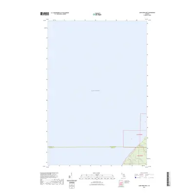
2023 Map of Carp River West
USGS Topo · Published 2023About this map
Lake Superior dominates the northern expanse of this coastal Michigan quadrant, where the waters of the Little Carp River flow toward the shoreline. The land here is defined by the sharp transition from the lake to the elevation of the Porcupine Mountains region, a landscape where water and terrain create distinct natural landmarks. Hikers and researchers can trace the path of the North Country National Scenic Trl as it winds through the southern portion of the map, crossing the county line between Ontonagon and Gogebic counties. Notable topographic features such as Bathtub Falls and Traders Falls indicate the steep drops and hydraulic character of the local river systems as they descend toward the Great Lakes basin.
Find a feature on this map
8 named features on this map. Tap any name to fly to it.
Don’t see what you’re looking for? This feature index may not catch every label — zoom into the map to look around manually.
Map Details
Editions of this 2023 Carp River West Map
This is the sole edition of this map. No revisions or reprints were ever made.
Other maps of this area

1953 · Ashland
USGS Topo · 1:250,000

1956 · Carp River
USGS Topo · 1:62,500

1956 · North Ironwood
USGS Topo · 1:62,500

1956 · Thomaston
USGS Topo · 1:62,500

1958 · Ashland
USGS Topo · 1:250,000

1958 · Iron River
USGS Topo · 1:250,000

1960 · Iron River
USGS Topo · 1:250,000

1961 · Iron River
USGS Topo · 1:250,000

1967 · Iron River
USGS Topo · 1:250,000

1979 · Ontonagon
USGS Topo · 1:100,000