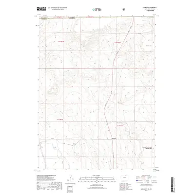
2019 Map of Carr East
USGS Topo · Published 2019About this map
The high plains of Weld County meet the Wyoming border in this modern topographic landscape, defined by wide drainage basins and a scattered rural settlement pattern. Rockport and Carr serve as the primary hubs in this dry upland region, where the terrain is marked by the prominent Simpson Mesa and a network of ephemeral waterways. The geography is characterized by the presence of the Pawnee National Grassland, which preserves a significant portion of this shortgrass prairie ecosystem. Water management and drainage are traced through the paths of Lone Tree Creek and Owl Creek, alongside smaller tributaries like Little Owl Creek and Simpson Creek. Transportation and local aviation are represented by a grid of county roads and the Mile Hi Airport, illustrating how local connectivity and land use have adapted to the expansive vistas of Northern Colorado.
Find a feature on this map
25 named features on this map. Tap any name to fly to it.
Don’t see what you’re looking for? This feature index may not catch every label — zoom into the map to look around manually.
Map Details
Editions of this 2019 Carr East Map
This is the sole edition of this map. No revisions or reprints were ever made.
Other maps of this area

1908 · Eaton
USGS Topo · 1:125,000

1910 · Eaton
USGS Topo · 1:125,000

1911 · Cheyenne
USGS Topo · 1:125,000

1914 · Cheyenne
USGS Topo · 1:125,000

1950 · Cheyenne
USGS Topo · 1:62,500

1954 · Cheyenne
USGS Topo · 1:250,000

1954 · Greeley
USGS Topo · 1:250,000

1957 · Greeley
USGS Topo · 1:250,000

1958 · Cheyenne
USGS Topo · 1:250,000

1958 · Greeley
USGS Topo · 1:250,000