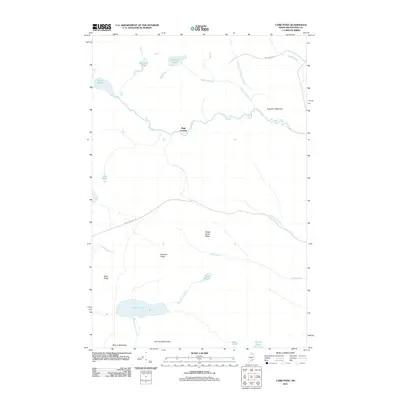
2011 Map of Carr Pond
USGS Topo · Published 2011About this map
High Landing serves as a central reference point in this northern Maine landscape, where the Fish River winds through a network of remote waterways and ridges. The river's course is punctuated by Fish River Falls and Skew Falls, illustrating the descent from the surrounding uplands toward the lower valleys. This 2011 survey captures a terrain defined by high-elevation water bodies like Carr Pond and Moccasin Pond, which are framed by prominent landforms including Carr Pond Mountain and Ferguson Mountain. The sparse road network, consisting of Wilderness Rd and W Side Echo Lake Rd, underscores the isolated character of the region. Local hydrology is further detailed by numerous smaller tributaries such as Chase Brook and Mud Pond Stream, which drain the ridges and feed into the larger ponds and rivers that have long shaped the geography of Aroostook County.
Find a feature on this map
27 named features on this map. Tap any name to fly to it.
Don’t see what you’re looking for? This feature index may not catch every label — zoom into the map to look around manually.
Map Details
Editions of this 2011 Carr Pond Map
This is the sole edition of this map. No revisions or reprints were ever made.
Other maps of this area

1928 · Winterville
USGS Topo · 1:48,000

1930 · Greenlaw
USGS Topo · 1:48,000

1931 · Fish River Lake
USGS Topo · 1:48,000

1931 · Mooseleuk Lake
USGS Topo · 1:48,000

1931 · Winterville
USGS Topo · 1:62,500

1933 · Greenlaw
USGS Topo · 1:62,500

1935 · Fish River Lake
USGS Topo · 1:62,500

1935 · Mooseleuk Lake
USGS Topo · 1:62,500

1954 · Presque Isle
USGS Topo · 1:250,000

1958 · Presque Isle
USGS Topo · 1:250,000