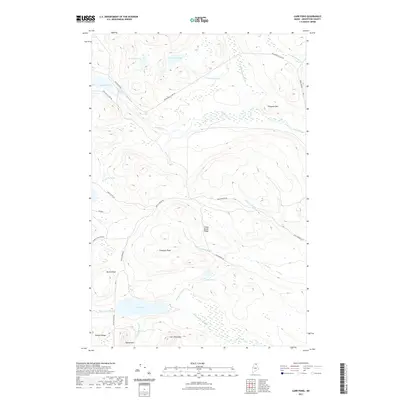
2021 Map of Carr Pond
USGS Topo · Published 2021About this map
The Fish River flows through this remote section of Aroostook County, marked by the turbulent waters of Fish River Falls and Skew Falls. This interior landscape is defined by a series of interconnected water bodies and prominent ridges, including Carr Pond at the base of Carr Pond Mtn and Sheldon Ridge. The area's character is fundamentally tied to its timber and sporting geography, where primitive routes like Wilderness Island Rd and Hewes Brk Rd provide access to isolated points such as Moccasin Pond and Ferguson Pond. To the south, Bishop Mtn and Bishop Pond Stream frame a rugged terrain that remains largely undeveloped, preserving a network of natural drainage and high-elevation outlooks like Freeman Ridge and Chase Brook Ridge.
Find a feature on this map
35 named features on this map. Tap any name to fly to it.
Don’t see what you’re looking for? This feature index may not catch every label — zoom into the map to look around manually.
Map Details
Editions of this 2021 Carr Pond Map
This is the sole edition of this map. No revisions or reprints were ever made.
Other maps of this area

1928 · Winterville
USGS Topo · 1:48,000

1930 · Greenlaw
USGS Topo · 1:48,000

1931 · Fish River Lake
USGS Topo · 1:48,000

1931 · Mooseleuk Lake
USGS Topo · 1:48,000

1931 · Winterville
USGS Topo · 1:62,500

1933 · Greenlaw
USGS Topo · 1:62,500

1935 · Fish River Lake
USGS Topo · 1:62,500

1935 · Mooseleuk Lake
USGS Topo · 1:62,500

1954 · Presque Isle
USGS Topo · 1:250,000

1958 · Presque Isle
USGS Topo · 1:250,000