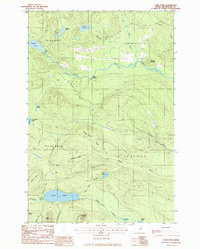
1985 Map of Carr Pond
USGS Topo · Published 1986About this map
Fish River winds through the northern reaches of this Aroostook County landscape, punctuated by several rapids and the High Landing site. The topography is defined by the transition between low-lying wetland basins and prominent elevations such as Ferguson Mountain and Carr Pond Mountain. To the south, Carr Pond and the headwaters of Chase Stream dominate a basin framed by Freeman Ridge and North Ridge.
Find a feature on this map
30 named features on this map. Tap any name to fly to it.
Don’t see what you’re looking for? This feature index may not catch every label — zoom into the map to look around manually.
Map Details
Editions of this 1985 Carr Pond Map
This is the sole edition of this map. No revisions or reprints were ever made.
Other maps of this area

1928 · Winterville
USGS Topo · 1:48,000

1930 · Greenlaw
USGS Topo · 1:48,000

1931 · Fish River Lake
USGS Topo · 1:48,000

1931 · Mooseleuk Lake
USGS Topo · 1:48,000

1931 · Winterville
USGS Topo · 1:62,500

1933 · Greenlaw
USGS Topo · 1:62,500

1935 · Fish River Lake
USGS Topo · 1:62,500

1935 · Mooseleuk Lake
USGS Topo · 1:62,500

1954 · Presque Isle
USGS Topo · 1:250,000

1958 · Presque Isle
USGS Topo · 1:250,000