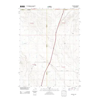
2013 Map of Carr West
USGS Topo · Published 2013About this map
Carr and the surrounding high plains of Weld County stand at a geographical crossroads where the Colorado and Wyoming borders meet. This 2013 survey captures the intersection of Larimer and Weld counties, a landscape defined by seasonal watercourses and the sparse settlements of the western prairie. Scattered ranching and utility sites like Meadow Springs Ranch and Antelope Windmill suggest the region's agricultural reliance on groundwater and intermittent flows from Lone Tree Creek and Spotwood Creek. The map also documents the locations of Norfolk, Warren, and Barton Camp, providing a detailed record of the road network including Co Road 126 and Co Road 17 as they connect these remote outposts. This topographic study reflects the modern character of a borderland region where long-established ranching interests coexist with the primary transit corridors of the northern Front Range.
Find a feature on this map
30 named features on this map. Tap any name to fly to it.
Don’t see what you’re looking for? This feature index may not catch every label — zoom into the map to look around manually.
Map Details
Editions of this 2013 Carr West Map
This is the sole edition of this map. No revisions or reprints were ever made.
Other maps of this area

1905 · Sherman
USGS Topo · 1:125,000

1907 · Livermore
USGS Topo · 1:125,000

1908 · Eaton
USGS Topo · 1:125,000

1909 · Livermore
USGS Topo · 1:125,000

1910 · Eaton
USGS Topo · 1:125,000

1911 · Cheyenne
USGS Topo · 1:125,000

1914 · Cheyenne
USGS Topo · 1:125,000

1950 · Cheyenne
USGS Topo · 1:62,500

1954 · Cheyenne
USGS Topo · 1:250,000

1954 · Greeley
USGS Topo · 1:250,000