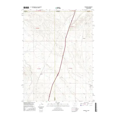
2016 Map of Carr West
USGS Topo · Published 2016About this map
Carr sits near the southeastern corner of this landscape, positioned along a network of local thoroughfares including Stevenson Ave and Gray Ave. The terrain is defined by a series of drainages that cross the border between Colorado and Wyoming, including Lone Tree Cr, Spottedwood Cr, and Spring Cr. These seasonal watercourses carve through the high plains, shaping the development of early settlements and ranching outposts. Small community centers such as Norfolk and Warren are identified alongside the local Po, reflecting the rural infrastructure of Northern Colorado in the early 21st century. The map highlights the intersection of several county roads, such as Co Rd 124 and Co Rd 19, which provide essential links between the scattered residential clusters and the surrounding agricultural lands.
Find a feature on this map
28 named features on this map. Tap any name to fly to it.
Don’t see what you’re looking for? This feature index may not catch every label — zoom into the map to look around manually.
Map Details
Editions of this 2016 Carr West Map
This is the sole edition of this map. No revisions or reprints were ever made.
Other maps of this area

1905 · Sherman
USGS Topo · 1:125,000

1907 · Livermore
USGS Topo · 1:125,000

1908 · Eaton
USGS Topo · 1:125,000

1909 · Livermore
USGS Topo · 1:125,000

1910 · Eaton
USGS Topo · 1:125,000

1911 · Cheyenne
USGS Topo · 1:125,000

1914 · Cheyenne
USGS Topo · 1:125,000

1950 · Cheyenne
USGS Topo · 1:62,500

1954 · Cheyenne
USGS Topo · 1:250,000

1954 · Greeley
USGS Topo · 1:250,000