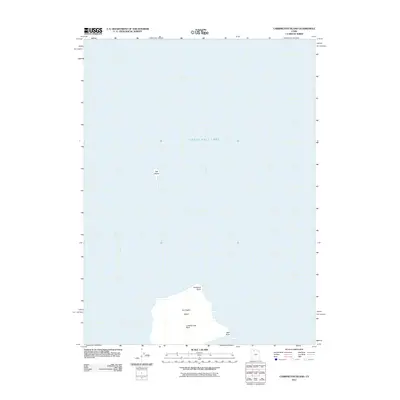
2011 Map of Carrington Island
USGS Topo · Published 2011About this map
Carrington Island and the surrounding waters of the Great Salt Lake define this 2011 quadrangle in Tooele County. The island, located within the southern portion of the lake, is flanked by Carrington Bay to the west and Gilbert Bay to the east. Several specific coastal and geological markers are identified along the island's perimeter, including Stoddard Point at its northern tip and Sac Point to the southeast. To the north of the main landmass, the isolated Hat Island rises from the lake bed. This map represents the desert island landscape prior to recent fluctuations in lake levels, documenting landmarks such as Lambournes Rock that serve as critical reference points for hydrologists and local historians tracking the island's shoreline geometry.
Find a feature on this map
8 named features on this map. Tap any name to fly to it.
Don’t see what you’re looking for? This feature index may not catch every label — zoom into the map to look around manually.
Map Details
Editions of this 2011 Carrington Island Map
This is the sole edition of this map. No revisions or reprints were ever made.
Other maps of this area

1885 · Tooele Valley
USGS Topo · 1:250,000

1953 · Tooele
USGS Topo · 1:250,000

1954 · Brigham City
USGS Topo · 1:250,000

1955 · Tooele
USGS Topo · 1:250,000

1958 · Brigham City
USGS Topo · 1:250,000

1962 · Brigham City
USGS Topo · 1:250,000

1968 · Promontory Point
USGS Topo · 1:24,000

1968 · Plug Peak NW
USGS Topo · 1:24,000

1968 · Carrington Island SW
USGS Topo · 1:24,000

1968 · Fremont Island SW
USGS Topo · 1:24,000