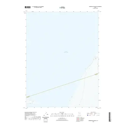
2020 Map of Carrington Island SW
USGS Topo · Published 2020About this map
The vast expanse of the Great Salt Lake dominates this 2020 map, illustrating the remote and aquatic character of the region. The map captures a section of the lake's open waters and shoreline where the administrative boundary between Box Elder Co and Tooele Co cuts across the basin. This boundary line represents a significant geopolitical division through the brine-rich environment, showing how county jurisdictions extend even into the uninhabited reaches of the lake. The terrain shown is primarily submerged or coastal, reflecting the unique environmental conditions of this part of Utah where the water levels of the Great Salt Lake dictate the shifting shoreline.
Find a feature on this map
2 named features on this map. Tap any name to fly to it.
Don’t see what you’re looking for? This feature index may not catch every label — zoom into the map to look around manually.
Map Details
Editions of this 2020 Carrington Island SW Map
This is the sole edition of this map. No revisions or reprints were ever made.
Other maps of this area

1885 · Tooele Valley
USGS Topo · 1:250,000

1953 · Tooele
USGS Topo · 1:250,000

1954 · Brigham City
USGS Topo · 1:250,000

1955 · Tooele
USGS Topo · 1:250,000

1958 · Brigham City
USGS Topo · 1:250,000

1962 · Brigham City
USGS Topo · 1:250,000

1968 · Carrington Island SW
USGS Topo · 1:24,000

1968 · Deardens Knoll
USGS Topo · 1:24,000

1968 · Badger Island NW
USGS Topo · 1:24,000

1968 · Badger Island
USGS Topo · 1:24,000