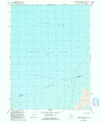
1991 Map of Carrington Island SW
USGS Topo · Published 1991About this map
The Great Salt Lake dominates this 1991 survey, specifically the expansive waters of Gilbert Bay and the shallower reaches of Carrington Bay. This map captures a strictly lacustrine and shoreline environment where the liquid surface of the lake meets the extensive Mud flats of the western Utah desert. A significant administrative feature is the Box Elder Co Tooele Co line, which is marked here as an Indefinite Boundary through the water and wetlands.
Find a feature on this map
7 named features on this map. Tap any name to fly to it.
Don’t see what you’re looking for? This feature index may not catch every label — zoom into the map to look around manually.
Map Details
Editions of this 1991 Carrington Island SW Map
This is the sole edition of this map. No revisions or reprints were ever made.
Other maps of this area

1885 · Tooele Valley
USGS Topo · 1:250,000

1953 · Tooele
USGS Topo · 1:250,000

1954 · Brigham City
USGS Topo · 1:250,000

1955 · Tooele
USGS Topo · 1:250,000

1958 · Brigham City
USGS Topo · 1:250,000

1962 · Brigham City
USGS Topo · 1:250,000

1968 · Carrington Island SW
USGS Topo · 1:24,000

1968 · Deardens Knoll
USGS Topo · 1:24,000

1968 · Badger Island NW
USGS Topo · 1:24,000

1968 · Badger Island
USGS Topo · 1:24,000