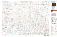
1994 Map of Carrington
USGS Topo · Published 1994About this map
Carrington serves as the focal point of this Central North Dakota landscape, situated at the intersection of prairie agriculture and extensive wetland conservation. The region is defined by the Pipestem Creek drainage system and a dense network of lakes and marshes, much of which is protected under the National Waterfowl Production Area system. Key ecological features include the Chase Lake National Wildlife Refuge and numerous state game management areas like Horsehead Lake State Game Management Area. Small rail-aligned settlements such as Sykeston, Hurdsfield, and Tuttle are scattered across the plains, while larger features like Lake Williams and Sliver Lake anchor the aquatic geography. This mid-1990s record captures the region's character as a vital migratory corridor, where managed wildlife habitats coexist with established prairie townships.
Find a feature on this map
97 named features on this map. Tap any name to fly to it.
Don’t see what you’re looking for? This feature index may not catch every label — zoom into the map to look around manually.
Map Details
Editions of this 1994 Carrington Map
This is the sole edition of this map. No revisions or reprints were ever made.
Other maps of this area

1896 · Jamestown
USGS Topo · 1:125,000

1900 · Pingree
USGS Topo · 1:125,000

1900 · Pingree
USGS Topo · 1:62,500

1944 · Brantford
USGS Topo · 1:62,500

1945 · Manfred
USGS Topo · 1:62,500

1946 · Brantford
USGS Topo · 1:62,500

1946 · Sheyenne Lake
USGS Topo · 1:48,000

1947 · Sheyenne Lake
USGS Topo · 1:62,500

1948 · New Rockford
USGS Topo · 1:62,500

1948 · Cathay
USGS Topo · 1:62,500