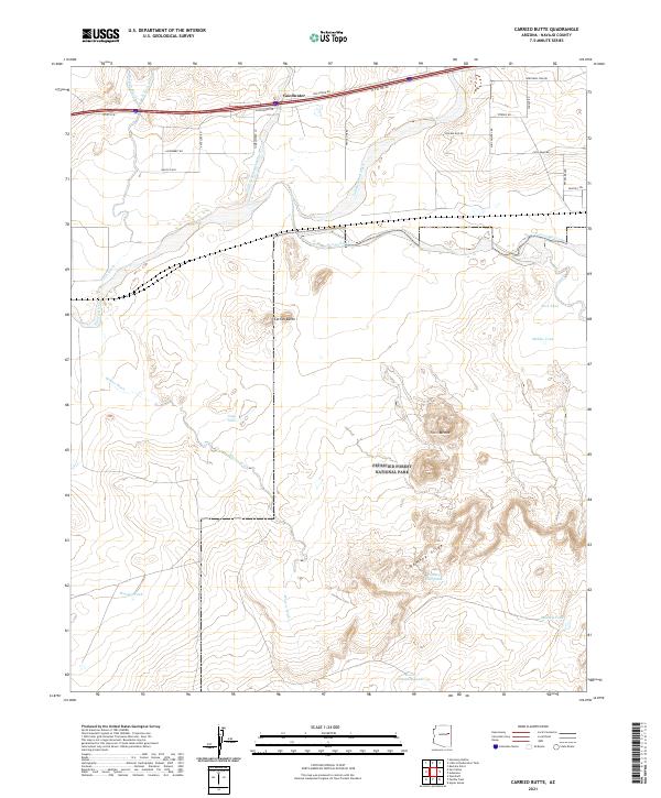
2021 Map of Carrizo Butte
USGS Topo · Published 2021About this map
Petrified Forest National Park occupies the central and southern portions of this landscape, where the arid high desert is carved by the Puerco River and its numerous ephemeral drainage systems. The northern edge of the map features the settlement of Goodwater, a small community situated along the corridor of Old US Hwy 66 and the interstate. This area serves as a significant transit route through the Painted Desert, marked by a network of named tracks and trails like Deatley Trl and Jackrabbit Rd that cross the townships.
Find a feature on this map
43 named features on this map. Tap any name to fly to it.
Don’t see what you’re looking for? This feature index may not catch every label — zoom into the map to look around manually.
Map Details
Editions of this 2021 Carrizo Butte Map
This is the sole edition of this map. No revisions or reprints were ever made.
Other maps of this area

1883 · Tusayan
USGS Topo · 1:250,000

1886 · St Johns
USGS Topo · 1:250,000

1886 · Tusayan
USGS Topo · 1:250,000

1886 · Fort Defiance
USGS Topo · 1:250,000

1886 · Holbrook
USGS Topo · 1:250,000

1892 · Fort Defiance
USGS Topo · 1:250,000

1892 · St Johns
USGS Topo · 1:250,000

1893 · Holbrook
USGS Topo · 1:250,000

1912 · Petrified Forest
USGS Topo · 1:62,500

1947 · Flagstaff
USGS Topo · 1:250,000