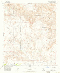
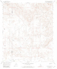
1957 Map of Carrizo Mtn NE
USGS Topo · Published 1958About this map
Old Carrizo Stage Station serves as a historical focal point in the southern portion of this desert landscape, situated along the Carrizo Creek. This site was a vital stop on the Old Overland Stage Route, a path that follows the natural drainage through the arid terrain. The map captures a transitional moment in land use, showing the intersection of conservation and military activity as the Anza - Borrego Desert State Park boundary meets the Impact Area Naval Reservation. The topography is defined by intricate drainage systems including Fish Creek, Deguynos Canyon, and Red Rock Canyon, which carve through the high ground near Split Mountain. Geologic features such as Red Hill and numerous survey benchmarks like BM 2371 Eagle provide precise navigational data for researchers and historians tracing mid-century desert exploration.
Find a feature on this map
18 named features on this map. Tap any name to fly to it.
Don’t see what you’re looking for? This feature index may not catch every label — zoom into the map to look around manually.
Map Details
Editions of this 1957 Carrizo Mtn NE Map
6 editions found
Other maps of this area

1915 · El Centro
USGS Topo · 1:125,000

1931 · Vallecito
USGS Topo · 1:125,000

1931 · Carrizo
USGS Topo · 1:125,000

1940 · Kane Spring
USGS Topo · 1:62,500

1940 · Plaster City
USGS Topo · 1:62,500

1942 · Barrel Spring
USGS Topo · 1:62,500

1942 · El Centro
USGS Topo · 1:250,000

1942 · Carrizo Mtn
USGS Topo · 1:62,500

1943 · Vallecito
USGS Topo · 1:125,000

1944 · Plaster City
USGS Topo · 1:62,500