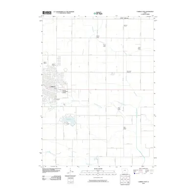
2010 Map of Carroll East
USGS Topo · Published 2010About this map
Carroll and Lidderdale anchor this western Iowa landscape, where the agricultural grid is defined by the winding paths of the Middle Raccoon River and Storm Creek. The area shows a distinct pattern of rural development, from the established city center of Carroll and its residential Carroll Community Estates to the small-town character of Lidderdale near the Lidderdale Post Office. Topography is marked by the prominence of Mount Moses in the northwest, while the southeastern portions are dominated by the waters of Swan Lake.
Find a feature on this map
45 named features on this map. Tap any name to fly to it.
Don’t see what you’re looking for? This feature index may not catch every label — zoom into the map to look around manually.
Map Details
Editions of this 2010 Carroll East Map
This is the sole edition of this map. No revisions or reprints were ever made.
Other maps of this area

1954 · Omaha
USGS Topo · 1:250,000

1954 · Fort Dodge
USGS Topo · 1:250,000

1957 · Omaha
USGS Topo · 1:250,000

1957 · Fort Dodge
USGS Topo · 1:250,000

1958 · Omaha
USGS Topo · 1:250,000

1958 · Fort Dodge
USGS Topo · 1:250,000

1971 · Dedham
USGS Topo · 1:24,000

1971 · Coon Rapids North
USGS Topo · 1:24,000

1971 · Templeton
USGS Topo · 1:24,000
1980 · Glidden
USGS Topo · 1:24,000