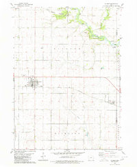
1980 Map of Glidden
USGS Topo · Published 1980About this map
The Chicago and North Western corridor defines the movement and settlement patterns of this Carroll County landscape, linking the grain-handling centers of Glidden and Ralston. This 1980 edition captures the region's agricultural productivity, punctuated by the gridded street plans of the towns and various civic landmarks such as the Radio Tower and Sewage Disposal plant.
Find a feature on this map
27 named features on this map. Tap any name to fly to it.
Don’t see what you’re looking for? This feature index may not catch every label — zoom into the map to look around manually.
Map Details
Editions of this 1980 Glidden Map
This is the sole edition of this map. No revisions or reprints were ever made.
Other maps of this area

1954 · Omaha
USGS Topo · 1:250,000

1954 · Fort Dodge
USGS Topo · 1:250,000

1957 · Omaha
USGS Topo · 1:250,000

1957 · Fort Dodge
USGS Topo · 1:250,000

1958 · Omaha
USGS Topo · 1:250,000

1958 · Fort Dodge
USGS Topo · 1:250,000

1971 · Dedham
USGS Topo · 1:24,000

1971 · Coon Rapids NE
USGS Topo · 1:24,000

1971 · Coon Rapids North
USGS Topo · 1:24,000

1980 · Carroll NE
USGS Topo · 1:24,000