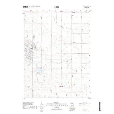
2018 Map of Carroll East
USGS Topo · Published 2018About this map
Carroll anchors this western Iowa landscape where the residential grid gives way to the agricultural drainage systems of the Middle Raccoon River and Storm Cr. The town's eastern expansion is visible through a network of residential streets like Mockingbird Dr and Capistrano Ave, while the surrounding countryside maintains its rural character with family-named crossings such as the Robin Avenue Bridge and the Olympic Avenue Bridge.
Find a feature on this map
64 named features on this map. Tap any name to fly to it.
Don’t see what you’re looking for? This feature index may not catch every label — zoom into the map to look around manually.
Map Details
Editions of this 2018 Carroll East Map
This is the sole edition of this map. No revisions or reprints were ever made.
Other maps of this area

1954 · Omaha
USGS Topo · 1:250,000

1954 · Fort Dodge
USGS Topo · 1:250,000

1957 · Omaha
USGS Topo · 1:250,000

1957 · Fort Dodge
USGS Topo · 1:250,000

1958 · Omaha
USGS Topo · 1:250,000

1958 · Fort Dodge
USGS Topo · 1:250,000

1971 · Dedham
USGS Topo · 1:24,000

1971 · Coon Rapids North
USGS Topo · 1:24,000

1971 · Templeton
USGS Topo · 1:24,000
1980 · Glidden
USGS Topo · 1:24,000