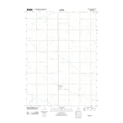
2011 Map of Carroll
USGS Topo · Published 2011About this map
Carroll serves as the primary hub of this agricultural landscape in northeast Nebraska, anchored by the Carroll Post Office near the junction of several section-line roads. The town is situated on a subtle rise north of Deer Creek, a drainage that flows through the southern portion of the township. Local history and genealogy are centered around the Elmwood Cemetery, located just south of the main settlement area near Sunrise Rd. The surrounding terrain is defined by a rhythmic grid of rural routes, such as 865th Rd and 565th Ave, which carve the prairie into distinct agricultural blocks. A series of watercourses, including Dog Creek and Baker Creek, meander across these fields, illustrating the natural drainage patterns that have dictated local land use and farm placement for generations.
Find a feature on this map
28 named features on this map. Tap any name to fly to it.
Don’t see what you’re looking for? This feature index may not catch every label — zoom into the map to look around manually.
Map Details
Editions of this 2011 Carroll Map
This is the sole edition of this map. No revisions or reprints were ever made.
Other maps of this area

1955 · Sioux City
USGS Topo · 1:250,000

1958 · Sioux City
USGS Topo · 1:250,000

1959 · Sioux City
USGS Topo · 1:250,000

1963 · Winside
USGS Topo · 1:24,000

1963 · Norfolk NE
USGS Topo · 1:24,000

1963 · Wayne
USGS Topo · 1:24,000
1971 · Laurel
USGS Topo · 1:24,000

1971 · Belden
USGS Topo · 1:24,000

1971 · Randolph South
USGS Topo · 1:24,000

1971 · Randolph North
USGS Topo · 1:24,000