Loading...
Loading map...2021 Map of Carroll
USGS Topo · Published 2021About this map
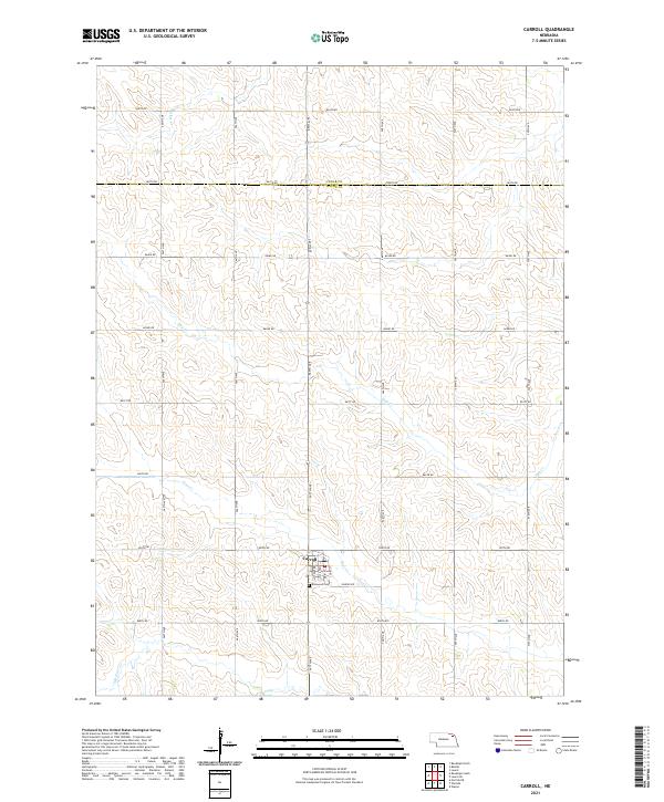
Carroll stands at the center of this agricultural landscape in northeast Nebraska, situated just south of the border between Cedar Co and Wayne Co. The village layout is clearly defined by its street grid, including Main St, Nebraska St, and Court St, while the Elmwood Cem sits on the southern edge of town near Sunrise Rd.
Find a feature on this map
26 named features on this map. Tap any name to fly to it.
Don’t see what you’re looking for? This feature index may not catch every label — zoom into the map to look around manually.
Map Details
Date Portrayed2021
Date Published2021
PublisherU.S. Geological Survey
Map TypeTopographic
Scale1:24000
Physical Dimensions24 x 29 inches
Editions of this 2021 Carroll Map
This is the sole edition of this map. No revisions or reprints were ever made.
Historical Maps of Precinct 21 Through Time
Featured Locations
Source Details
SourceU.S. Geological Survey
CopyrightPublic Domain