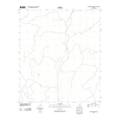
2010 Map of Carruthers Draw
USGS Topo · Published 2010About this map
Carruthers Draw and Miers Draw define the drainage patterns of this Val Verde County landscape, where seasonal watercourses have carved distinct pathways through the Edwards Plateau terrain. The map captures a moment in 2010 where land use is characterized by large-scale ranching operations and remote access roads. Named features like Old Ranch Draw point toward a history of pastoral activity, while Red Bluff Creek provides the primary hydrological landmark for the area. Connectivity is limited to isolated corridors such as Dolan Creek Rd and Hussie Meiers Rd, reflecting the sparse settlement typical of this portion of Southwest Texas near the Rio Grande basin.
Find a feature on this map
6 named features on this map. Tap any name to fly to it.
Don’t see what you’re looking for? This feature index may not catch every label — zoom into the map to look around manually.
Map Details
Editions of this 2010 Carruthers Draw Map
This is the sole edition of this map. No revisions or reprints were ever made.
Other maps of this area

1943 · Carta Valley
USGS Topo · 1:62,500

1944 · Flat Rock
USGS Topo · 1:62,500

1944 · Dry Devil
USGS Topo · 1:62,500

1944 · Devils Lake
USGS Topo · 1:62,500

1958 · Del Rio
USGS Topo · 1:250,000

1964 · Del Rio
USGS Topo · 1:250,000

1972 · Miers Ranch
USGS Topo · 1:24,000
1972 · Satan Canyon
USGS Topo · 1:24,000
1978 · Holcomb Draw
USGS Topo · 1:24,000
1978 · Open Hollow
USGS Topo · 1:24,000