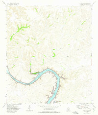
1972 Map of Satan Canyon
USGS Topo · Published 1975About this map
Amistad Reservoir dominates the lower portion of this arid Val Verde County landscape, where the rising waters of the Rio Grande basin submerged the lower reaches of the Devils River. The topography is defined by deep incisions through the Edwards Plateau, most notably at Satan Canyon and the winding course of Big Satan Creek. This 1970s era documentation, based on 1971 aerial photography, shows the reservoir at an elevation of 1117 feet, including the prominent northern curve at Slaughter Bend. A Gaging Sta stands at the mouth of the canyon, monitoring the erratic flow typical of this region's drainage systems. The map also delineates the boundaries of the National Recreation Area, reflecting the transition of this remote borderland into a managed hydraulic and recreational environment.
Find a feature on this map
12 named features on this map. Tap any name to fly to it.
Don’t see what you’re looking for? This feature index may not catch every label — zoom into the map to look around manually.
Map Details
Editions of this 1972 Satan Canyon Map
This is the sole edition of this map. No revisions or reprints were ever made.
Other maps of this area

1941 · Feely
USGS Topo · 1:62,500

1944 · Dry Devil
USGS Topo · 1:62,500

1944 · Devils Lake
USGS Topo · 1:62,500

1944 · Baker Crossing
USGS Topo · 1:62,500

1958 · Del Rio
USGS Topo · 1:250,000

1964 · Del Rio
USGS Topo · 1:250,000

1972 · California Creek
USGS Topo · 1:24,000

1972 · Miers Ranch
USGS Topo · 1:24,000

1972 · Rough Canyon SE
USGS Topo · 1:24,000
1972 · Gillis Ranch
USGS Topo · 1:24,000