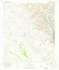
1972 Map of Gillis Ranch
USGS Topo · Published 1975About this map
Gillis Ranch serves as a lonely outpost in this arid stretch of Val Verde County, characterized by the winding path of the Devils River as it begins to swell into the Amistad Reservoir. The landscape is a complex network of dry washes and deeply incised drainages, including Dead Mans Creek, Evans Creek, and the curiously named Little Satan. Evidence of remote ranching life is visible through features like the private Landing Strip and scattered water sources such as the Drill Hole and several tanks.
Find a feature on this map
18 named features on this map. Tap any name to fly to it.
Don’t see what you’re looking for? This feature index may not catch every label — zoom into the map to look around manually.
Map Details
Editions of this 1972 Gillis Ranch Map
This is the sole edition of this map. No revisions or reprints were ever made.
Other maps of this area

1941 · Feely
USGS Topo · 1:62,500

1944 · Dry Devil
USGS Topo · 1:62,500

1944 · Devils Lake
USGS Topo · 1:62,500

1944 · Baker Crossing
USGS Topo · 1:62,500

1958 · Del Rio
USGS Topo · 1:250,000

1964 · Del Rio
USGS Topo · 1:250,000

1972 · California Creek
USGS Topo · 1:24,000
1972 · Box Canyon
USGS Topo · 1:24,000
1972 · Satan Canyon
USGS Topo · 1:24,000
1972 · Comstock
USGS Topo · 1:24,000