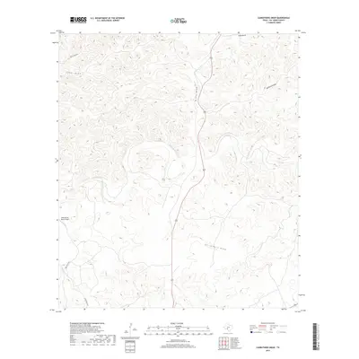
2019 Map of Carruthers Draw
USGS Topo · Published 2019About this map
Carruthers Draw and the surrounding plateau of Val Verde County define this high desert landscape, where seasonal drainage patterns have carved a intricate network of canyons and draws into the limestone. The terrain is largely defined by these namesake features, including Miers Draw and Cedar Draw in the north, and Piñon Draw further east. Transportation is limited to a few arterial ranch roads such as Dolan Creek Rd and Miers Ranch Rd, reflecting the large-scale landholdings and low population density of this West Texas region.
Find a feature on this map
10 named features on this map. Tap any name to fly to it.
Don’t see what you’re looking for? This feature index may not catch every label — zoom into the map to look around manually.
Map Details
Editions of this 2019 Carruthers Draw Map
This is the sole edition of this map. No revisions or reprints were ever made.
Other maps of this area

1943 · Carta Valley
USGS Topo · 1:62,500

1944 · Flat Rock
USGS Topo · 1:62,500

1944 · Dry Devil
USGS Topo · 1:62,500

1944 · Devils Lake
USGS Topo · 1:62,500

1958 · Del Rio
USGS Topo · 1:250,000

1964 · Del Rio
USGS Topo · 1:250,000

1972 · Miers Ranch
USGS Topo · 1:24,000
1972 · Satan Canyon
USGS Topo · 1:24,000
1978 · Holcomb Draw
USGS Topo · 1:24,000
1978 · Open Hollow
USGS Topo · 1:24,000