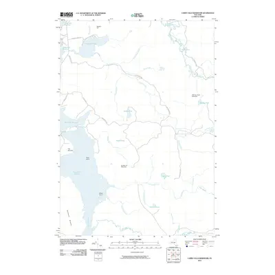
2010 Map of Carry Falls Reservoir
USGS Topo · Published 2010About this map
The Raquette River and its massive hydroelectric impoundments dominate this section of the Adirondack Park in the early 21st century. The map details the interconnected water system of the Carry Falls Reservoir, Stark Falls Reservoir, and Blake Falls Reservoir, which transformed the local topography. These man-made bodies of water are punctuated by features like Radio Island and Maple Island, while the surrounding terrain rises to local summits such as Hollywood Mountain and Bog Mountain.
Find a feature on this map
38 named features on this map. Tap any name to fly to it.
Don’t see what you’re looking for? This feature index may not catch every label — zoom into the map to look around manually.
Map Details
Editions of this 2010 Carry Falls Reservoir Map
This is the sole edition of this map. No revisions or reprints were ever made.
Other maps of this area

1908 · Potsdam
USGS Topo · 1:62,500

1919 · Nicholville
USGS Topo · 1:62,500

1920 · Childwold
USGS Topo · 1:62,500

1921 · Childwold
USGS Topo · 1:48,000

1921 · Nicholville
USGS Topo · 1:62,500

1921 · Stark
USGS Topo · 1:62,500

1922 · Childwold
USGS Topo · 1:62,500

1923 · Stark
USGS Topo · 1:62,500

1940 · Stark
USGS Topo · 1:62,500

1942 · Long Bow
USGS Topo · 1:24,000