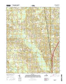
2016 Map of Carson
USGS Topo · Published 2016About this map
Rowanty Creek and its many tributaries, including Harvells Branch and Fox Branch, dominate this landscape at the intersection of Dinwiddie, Prince George, and Sussex Counties. The settlement patterns reflect a rural history tied to the land's drainage, with the larger swamp systems like Jones Hole Swamp and Warwick Swamp influencing road placement and farm boundaries. Significant local landmarks such as Monkneck Bridge and the Confederate Cemetery provide grounding for family historians and researchers of Virginia's complex past. This survey documents the transition between the small communities of Reams, Rowanta, and Carson, showing their spatial relationship to established thoroughfares like Old Stage Road and Halifax Road. The presence of Laniers Millpond and several churches, such as Little Zion Church, suggests the long-standing centers of social and economic life in this region south of Petersburg.
Find a feature on this map
74 named features on this map. Tap any name to fly to it.
Don’t see what you’re looking for? This feature index may not catch every label — zoom into the map to look around manually.
Map Details
Editions of this 2016 Carson Map
This is the sole edition of this map. No revisions or reprints were ever made.
Other maps of this area

1894 · Petersburg
USGS Topo · 1:62,500

1897 · Amelia
USGS Topo · 1:125,000

1919 · Jarratt
USGS Topo · 1:62,500

1919 · Mc Kenney
USGS Topo · 1:48,000

1921 · Mc Kenney
USGS Topo · 1:62,500

1943 · Mc Kenney
USGS Topo · 1:62,500

1943 · Dinwiddie
USGS Topo · 1:24,000

1943 · Sutherland
USGS Topo · 1:24,000

1943 · Richmond
USGS Topo · 1:250,000

1944 · Reams
USGS Topo · 1:31,680