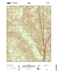
2019 Map of Carson
USGS Topo · Published 2019About this map
Rowanta and Carson anchor this part of Southside Virginia, where the landscape is defined by an intricate network of wetlands and sluggish watercourses. The drainage of Rowanty Cr and its many tributaries, such as Arthur Swamp and Warren Swamp, creates a complex terrain of wooded lowlands. Cultural history is prominently marked by numerous burial sites, including the Confederate Cem, Rowanta Cem, and Little Zion Cem, which reflect the deep lineage of Dinwiddie County families and the area's civil war legacy.
Find a feature on this map
82 named features on this map. Tap any name to fly to it.
Don’t see what you’re looking for? This feature index may not catch every label — zoom into the map to look around manually.
Map Details
Editions of this 2019 Carson Map
This is the sole edition of this map. No revisions or reprints were ever made.
Other maps of this area

1894 · Petersburg
USGS Topo · 1:62,500

1897 · Amelia
USGS Topo · 1:125,000

1919 · Jarratt
USGS Topo · 1:62,500

1919 · Mc Kenney
USGS Topo · 1:48,000

1921 · Mc Kenney
USGS Topo · 1:62,500

1943 · Mc Kenney
USGS Topo · 1:62,500

1943 · Dinwiddie
USGS Topo · 1:24,000

1943 · Sutherland
USGS Topo · 1:24,000

1943 · Richmond
USGS Topo · 1:250,000

1944 · Reams
USGS Topo · 1:31,680