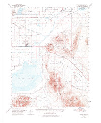
1951 Map of Carson Lake
USGS Topo · Published 1974About this map
The Fallon Naval Auxiliary Air Station and the agricultural efforts of the Lahon Tan Valley define this mid-century Nevada landscape. The map reveals an intricate network of irrigation and drainage infrastructure, such as the S-1 Canal and Harmon Drain, which converted these arid flats into productive land. Near the northern edge, the community of Stillwater and the Harmon School anchor a rural population living alongside the Fallon Indian Reservation.
Find a feature on this map
57 named features on this map. Tap any name to fly to it.
Don’t see what you’re looking for? This feature index may not catch every label — zoom into the map to look around manually.
Map Details
Editions of this 1951 Carson Lake Map
3 editions found
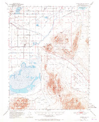
Other maps of this area

1908 · Carson Sink
USGS Topo · 1:250,000

1910 · Carson Sink
USGS Topo · 1:250,000

1950 · Stillwater
USGS Topo · 1:62,500

1951 · Carson Lake
USGS Topo · 1:62,500

1951 · Allen Springs
USGS Topo · 1:62,500

1951 · Soda Lake
USGS Topo · 1:62,500

1951 · Weber Reservoir
USGS Topo · 1:62,500

1951 · Fallon
USGS Topo · 1:62,500

1957 · Reno
USGS Topo · 1:250,000

1959 · Reno
USGS Topo · 1:250,000