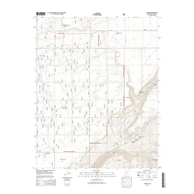
2013 Map of Carson
USGS Topo · Published 2013About this map
Rio Grande gorge dominates the eastern landscape of this 2013 survey, where the river carves through the basaltic plateaus of northern New Mexico. The small settlements of Carson, Pilar, and Barranca serve as primary human anchors in a terrain otherwise defined by deep drainages and volcanic remnants. Within the Carson National Forest, the map captures a complex network of arroyos such as Ashbury Arroyo and Arroyo Noria, which channel seasonal runoff into the main river corridor. These features highlight the importance of water management in this arid environment, evidenced by livestock water points like Mantosa Tank and Hartig Tank. Down in the canyon, the river's character is marked by technical stretches including The Narrows Rapid and Alberts Falls Rapid, while the Gaging Station near Hondo Canyon monitors the critical flows that have sustained local ranching operations like the Drake Ranch for generations.
Find a feature on this map
40 named features on this map. Tap any name to fly to it.
Don’t see what you’re looking for? This feature index may not catch every label — zoom into the map to look around manually.
Map Details
Editions of this 2013 Carson Map
This is the sole edition of this map. No revisions or reprints were ever made.
Other maps of this area

1953 · Velarde
USGS Topo · 1:24,000

1953 · Trampas
USGS Topo · 1:24,000

1954 · Raton
USGS Topo · 1:250,000

1958 · Raton
USGS Topo · 1:250,000

1960 · Taos Junction
USGS Topo · 1:24,000

1961 · Carson
USGS Topo · 1:24,000

1961 · Tres Orejas
USGS Topo · 1:24,000

1961 · Servilleta Plaza
USGS Topo · 1:24,000

1964 · Los Cordovas
USGS Topo · 1:24,000

1964 · Penasco
USGS Topo · 1:24,000