
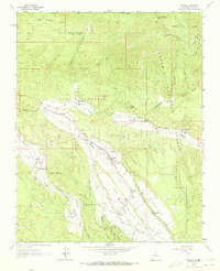
1964 Map of Penasco
USGS Topo · Published 1967About this map
Picuris Pueblo and the valley of the Rio Pueblo define this mid-1960s landscape, where traditional land grants and community acequias intersect with the Carson National Forest. The map documents a dense network of Catholic and Protestant sites, such as San Lorenzo Ch and the United Emanuel Ch, alongside several family-named burial grounds like the Virgilio Trujillo Cem and Ramon Sanchez Cem. The irrigation system is particularly prominent, with the Acequia Madre de Santa Barbara and Acequia Madre de Llano carrying water to the high-elevation fields of the Llano Santa Barbara. Evidence of the region's agricultural and spiritual foundations is found in every corner, from the Picuris Peak foothills to the small mountain settlements of Rodarte and Llano.
Find a feature on this map
57 named features on this map. Tap any name to fly to it.
Don’t see what you’re looking for? This feature index may not catch every label — zoom into the map to look around manually.
Map Details
Editions of this 1964 Penasco Map
2 editions found
Other maps of this area

1953 · Truchas
USGS Topo · 1:24,000

1953 · Trampas
USGS Topo · 1:24,000

1954 · Raton
USGS Topo · 1:250,000

1958 · Raton
USGS Topo · 1:250,000

1961 · Carson
USGS Topo · 1:24,000

1964 · Tres Ritos
USGS Topo · 1:24,000

1964 · Ranchos De Taos
USGS Topo · 1:24,000

1964 · Taos SW
USGS Topo · 1:24,000
1964 · Jicarita Peak
USGS Topo · 1:24,000
1964 · El Valle
USGS Topo · 1:24,000