
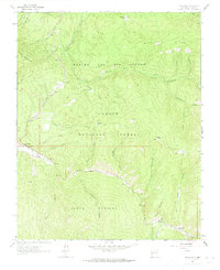
1964 Map of Tres Ritos
USGS Topo · Published 1967About this map
Carson National Forest terrain dominates this mid-century survey of the Sangre de Cristo foothills, where high-altitude ridges and deep canyons dictate the pattern of human activity. The southern edge of the map centers on the winding course of the Rio Pueblo, a vital water source that supports the settlement at Tres Ritos and the emerging recreational landscape of the Sipapu Ski Area. Notable for its legacy of Spanish land grants, the area is defined by the Rancho del Rio Grande and Santa Barbara boundaries, reflecting centuries of land use and complex property history.
Find a feature on this map
55 named features on this map. Tap any name to fly to it.
Don’t see what you’re looking for? This feature index may not catch every label — zoom into the map to look around manually.
Map Details
Editions of this 1964 Tres Ritos Map
2 editions found
Other maps of this area

1954 · Raton
USGS Topo · 1:250,000

1958 · Raton
USGS Topo · 1:250,000

1964 · Ranchos De Taos
USGS Topo · 1:24,000

1964 · Penasco
USGS Topo · 1:24,000

1964 · Taos SW
USGS Topo · 1:24,000
1964 · Jicarita Peak
USGS Topo · 1:24,000
1964 · El Valle
USGS Topo · 1:24,000

1965 · Holman
USGS Topo · 1:24,000

1965 · Shady Brook
USGS Topo · 1:24,000
1965 · Cerro Vista
USGS Topo · 1:24,000